Trail 80 km

The trail
Didrik Hermansen, winner of 80km several times, set a new course record in 2025 - with a time of 05:57:03.
In the women's class, Jasmin Nunige holds the course record of 6h54min11sec, set in 2016. And she did it with the disease MS!
The trail has a mix of forest roads, technical trails and lightly technical trails. A total of approximately 9% asphalt.
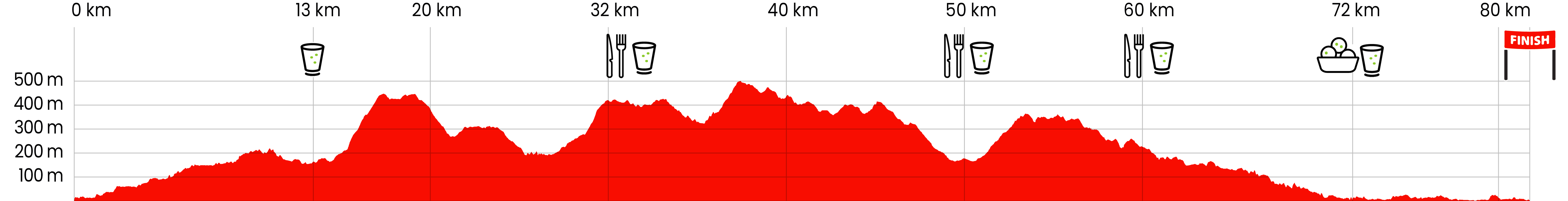
The distance is over 80 km. Watches do not measure the same, it is about algorithms and GPS registrations, among other things.
The first section has the 80km runners alone until the 50km participants start in Holmenkollen. On this section, the 80km runners will cross two peaks at an altitude of just under 420 meters.
The first mile goes up along the Akerselva River, which is an attraction and a common area for the city's residents. This nerve through the city has been important for the industrialization of both Oslo and Norway. The river has also historically formed the natural divide between east and west in Oslo. The Akerselva River is living proof of the residents' need for green spaces. It represents a link to the city's cultural history, and the walkways along it are widely used for running. There is also a rich population of animals and plants that live in and along the river.
The Akerselva River originates in Maridalsvannet, which the 80-kilometer trail circles. Maridalsvannet is Oslo's source of drinking water and marks the gateway to Oslo's unique outdoor recreation area: Nordmarka.
There is a dense network of trails for both summer and winter. Nordmarka actually starts in the middle of Oslo and is easy to reach both on foot and via public transport.
The hiking trails are maintained by DNT Oslo and the surrounding area, while both the Ski Association and Oslo Municipality run ski trails in the winter - and it has happened that the ski season has lasted until May 11th.
The trail from Maridalsvannet is hilly. Just after the first drinking station outside Maridalen Church, the climb starts from Hønefoten to 416 m above sea level and Fagervann. The lake is named for a reason.
Up by Fagervann it's really nice!
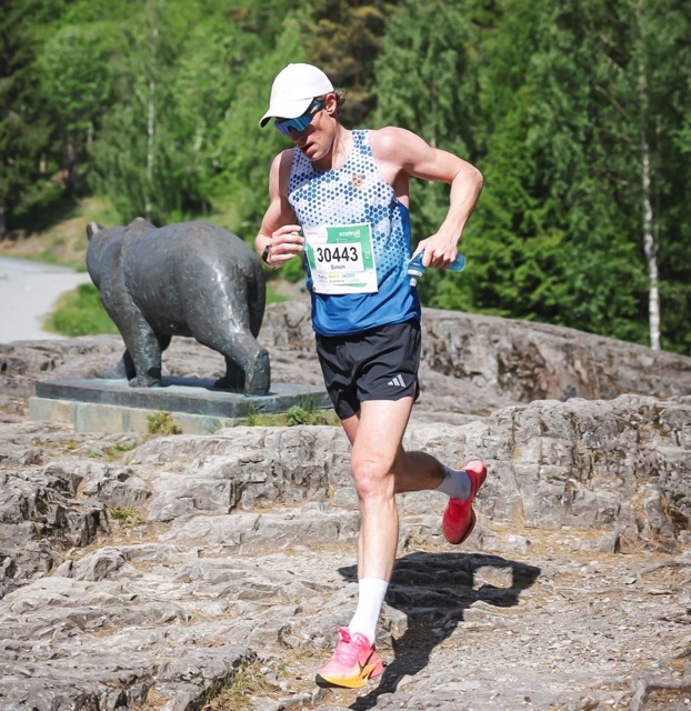
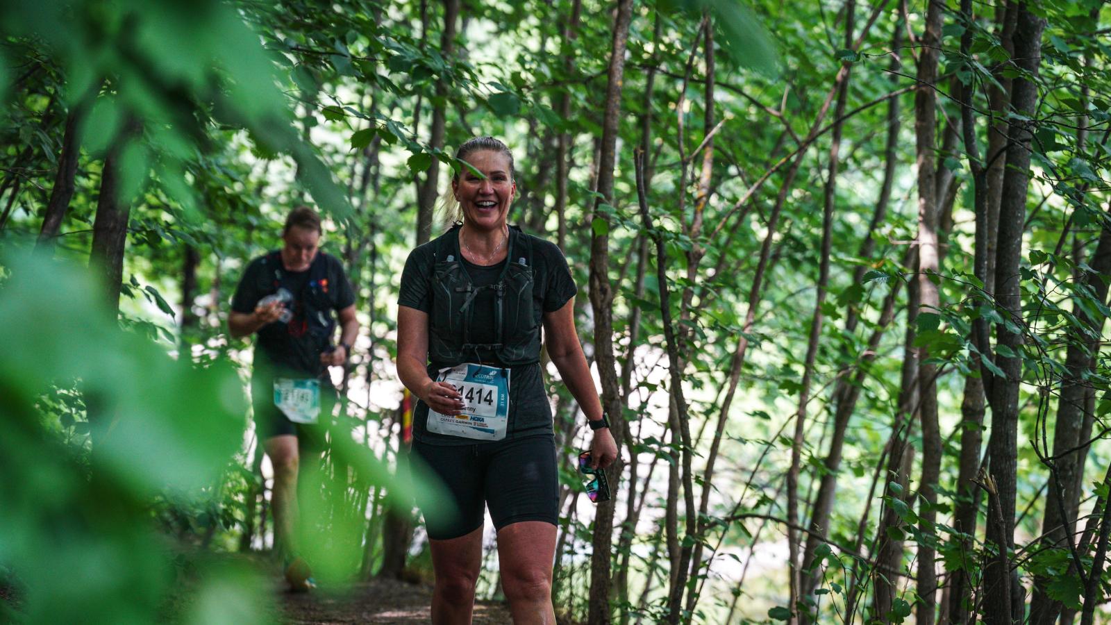
But you should be focused when running on the trails there, even when the descent starts! There are sections with slippery roots.
You will probably feel in parts of the route that you are far away from people, but the city is never far away. Of the places in the field where the trail touches the urban environment, we find Sognsvann. It is one of the city's most used areas for runners - and those who want to take a bath. By the way, the metro station right next door should make it possible for family and friends to come and cheer on the 80km runners! Because that is what they need. After Sognsvann (west side) a tough climb on the trail awaits.
Vettakolltoppen is the next point – 419 meters above sea level. There is a panoramic view of the city and the fjord. Of course, a photographer will be there to immortalize the 80 runners with Oslogryta in the background.
Then it continues onto cobblestone paths over Fuglemyra. A beautiful area where it is easy to believe you are miles away from densely populated areas. But then it is still only about three kilometers until the 80km runners reach the first food station. By then they will have run 32 km and hopefully get a nice boost of cheers from the 50km runners who will hook up and start at 11 am.
After the food station in Holmenkollen and past the country's largest tourist attraction, the ski jump, there is a slight climb again before the trail turns off at Voksenkollen station in the direction down towards Sørkedalen's several farms. From the food station at Sørkedalen Idrettsanleg, there is more climbing and beautiful forest paths over to the Fossum food station.
From there you will go along Bogstadvannet, a popular hiking area. And just as the race started up a river – the Akerselva, it will now (almost) end down another river – the Lysakerelva. But it doesn’t just go downhill! The course here is technical and absolutely hilly! This is a particularly beautiful natural area. The lush vegetation and the beautiful paths that follow the river give a feeling of being far away from the city. But in fact we are here in the middle of one of Norway’s most densely populated areas. In short, the Lysakerelva is a beautiful oasis. There are dead trees on or along the paths there, but they should be. Dead trees are important for the ecosystem.
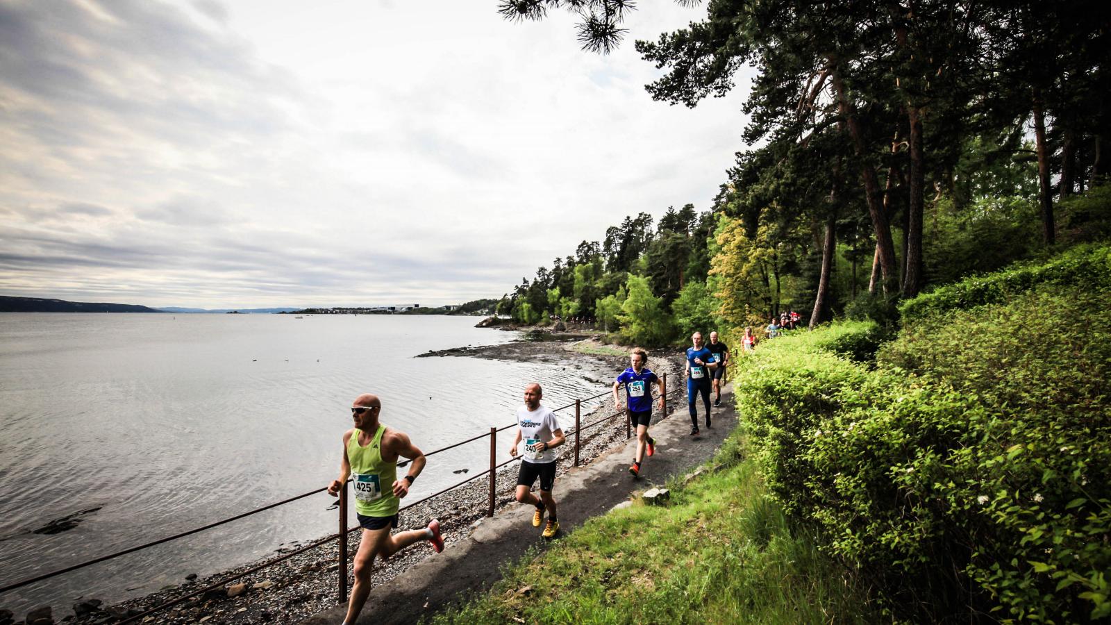
From Lysaker station the trail runs along the fjord and the beautiful Vækerøparken. Next you will see the last drink station on the walkway by Thaugland Trelasthandel. Then you have just over 8+ km left. You will enter rural Bygdøy where the race is mostly on gravel and some asphalt before you finally reach the finish line at the beach at Huk on Bygdøy!
It is a varied and just over 80 km!
CUT OFF TIMES AND SUPPORT STATIONS:
Support allowed only within the stations. We do not have drop bags. See FAQ for locations and what is served at the stations.
- Maridalen Church - Maridalsenveien 952
First station for 80 km, approximately 13.4 km from the start. Open from 07:40-09:30. Water and sports drinks - Break and food station Holmenkollen/Thomas Heftye villa
(same place as the 50km start) after 32 km from the start. Closes 13:00. Water, sports drink, fruit, chocolate/bakery. - Break and food station Sørkedalen
(same place as the 31km start) after 51 km from the start. Closes 16:00. Water, sports drink, fruit, pastries, lukewarm soup broth - Break and food station Fossum
(same place as the 21km start) after 61 km from the start. Closes 17:30. Water, sports drink, fruit, pastries, chocolate, lukewarm soup broth - Drinking station Thaugland
Approximately 8.5 km before the finish line. Closes at 19:00. Water, sports drink - Goal
Water, sports drink, snacks. Set-up from 20:00. The timing mat will be available until 20:30.
Practical
Distribution of starting numbers
A text message will be sent to your registered mobile number in advance with your starting number. If you do not receive the message, you can look up your number in your profile. Log in to the participant login, the same page as the registration page.
Wednesday: 10:00–19:00
Thursday: 10:00–19:00
Friday: 10:00–19:00
Saturday: In the starting area 06:15-06:55
Address for starting number distribution Anton Sport: Bogstadveien 2, Oslo
D-Day
Lower Waterfall Park
You can hand in a small bag with a luggage tag that will be transported to the finish line. Hand in no later than 10 minutes before the start!
The baggage car leaves at 7 am.
The starting area is called Nedre Foss Park.
Bus and tram within a short distance to the starting area.
Check what suits you best on Ruter.no .
At 7:00 AM
Five drink stations, three of which also have food

Industry

Cup, bladder, soft bottles or similar.

Mobile phone

Bank card/ID card

Payment method

Drinks from the start to the first station and further during the race:
Drink TO start
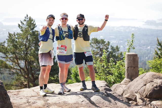
They did it!
Moments of achievement, community and emotion, captured in the heart of nature and in the heart of Oslo. Welcome to the world of EcoTrail.
Prepare for the race
Event rules, race ethics and registration conditions.
Our other distances
.jpg)
Trail 50 km
For those who want to run longer than a marathon
Trail 31 km
The perfect distance
Trail 21 km
The most requested distance
Trail 10 km
A great 10km

Walk 21 km
For those of you who would rather go